What am I purchasing?
WeatherStrike reports provide weather data from NOAA/NWS Products for Hail, Wind and Tornadoes that occurred near a specific property site over a date range in chronological order (oldest event to most recent event). This weather data is typically used to determine when a “Severe” weather event occurred at or near the specific property site causing damage to the building envelope.
What is a WeatherStrike report for?
WeatherStrike reports provide weather data for a specific property site as a starting point to help determine the dates when a “Severe” weather event occurred causing damage to the building envelope.
How much does WeatherStrike cost?
WeatherStrike offers two report formats for different costs.
$49.95 per Basic Report, for a maximum date range of 7 years. A Basic Report contains summarized data in a chart format for the following NWS weather products:
$74.95 per Complete Report, for a maximum date range of 7 years plus a second 3 day Refined Report within the 7 years date range. A Complete Report contains all of the Basic Report (data summarized in a chart format) + detailed data for the following NWS weather products:
A WeatherStrike report aggregates data across a date range of your choosing down to a single
day. The maximum date range per report is 7 years. The following pre-paid options offer savings over purchasing reports individually:
Basic Reports
Complete Reports
Who uses WeatherStrike?
WeatherStrike reports are used by anyone needing weather data for determining damages to the exterior envelope of a building for specific dates. The list of typical users would include Home Owners, Architects, Engineers, Building Inspectors, Claim Adjusters, Attorneys, Insurance Agent/Carrier and Building/Complex Owners.
How did WeatherStrike start?
WeatherStrike started because of the confusion and difficulty of accurately capturing large "Hail" & high "Wind" weather events for a specific location over a specific date range. This weather information is critically important as a starting point to determine the date(s) large "Hail" and/or high "Wind" events occurred at or near a property site.
What dates and locations does WeatherStrike cover?
WeatherStrike reports have access to weather data from January 01, 2000, to the present available NOAA/NWS weather data. Data is updated on a daily basis. WeatherStrike reports are for the Continental US (48 States), Alaska & Hawaii.
How do I get a report?
What is in a report?
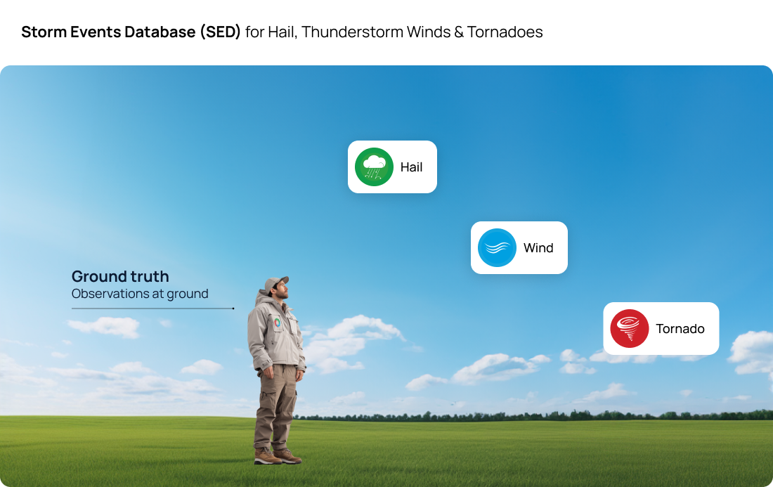
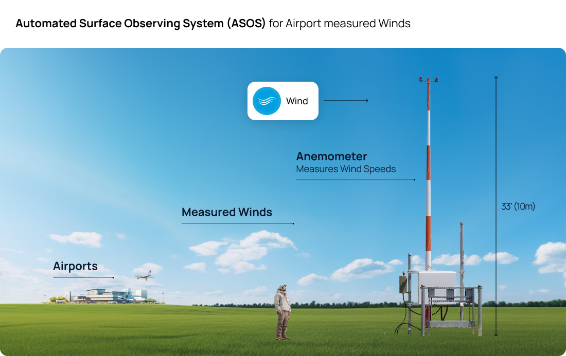
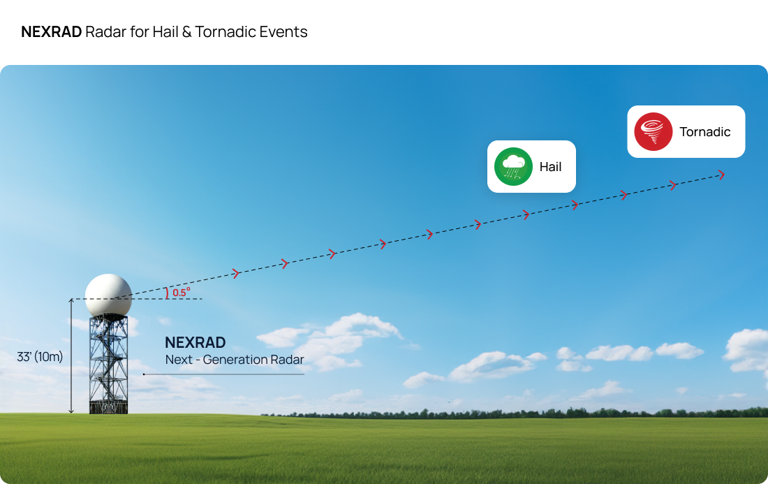
A WeatherStrike Report contains site-specific weather information for Hail, Thunderstorm Winds, Airport measured Winds, Tornadoes & Tornadic Events in chronological order over a date range you specify (spanning up to 7 years). This weather information for the property site is in a:
How do you determine what goes in a report?
The purpose of each WeatherStrike Report is to help determine the date(s) that large "Hail" or high "Wind" occurred at or near a Site-Specific location. National Weather Service Products are used in WeatherStrike reports:
What are the different National Weather Service Products in a report?
WeatherStrike reports provide weather data from NOAA/NWS Products for Hail, Wind and Tornadoes that occurred near a specific property site over a date range in chronological order (oldest event to most recent event). This weather data is typically used to determine when a “Severe” weather event occurred at or near the specific property site causing damage to the building envelope.


Can I trust the reports?
All data in WeatherStrike reports are from the National Oceanic and Atmospheric Administration (NOAA) / National Weather Service (NWS). The NWS data for the SED, ASOS, and SWDI products used in WeatherStrike reports are verified though Federal Quality Control Standards. The NWS is a branch of NOAA.
Why do I need to create an account / log in?
Your WeatherStrike reports are safely stored and accessed through your WeatherStrike account. Your account also allows you to manage an unlimited number of sites/properties. And finally, your account uses a secure third party payment platform. Payment information is not stored or seen by WeatherStrike.
Will WeatherStrike keep my information private?
Your privacy is very important to us. It is WeatherStrike’s policy to respect your privacy regarding any information we may collect while operating our website. We do not share your personal information with anyone except to comply with the law or protect our rights. We store information only to give you the most relevant and accurate weather data.
I manage multiple properties. Can WeatherStrike help?
With just a few clicks, quickly download WeatherStrike reports in bulk for any property sites in the Continental US (48 States), Alaska & Hawaii. Manage an unlimited number of property sites in your WeatherStrike account. If you need assistance with mass uploading properties, contact us directly at moc.ekistormmarkrtsrehtaew@bsav.
Use the form below or directly e-mail us. We will get back to you within 24 hours.